Going to the mountains is going home. – George Mallory

The Cordillera Region of the Philippines covers an extensive range of stunning mountains. It is an enormous wooded area thriving with a various range of flora and fauna. The main feature of these mountains are towering pine trees and different types of ferns and mosses.
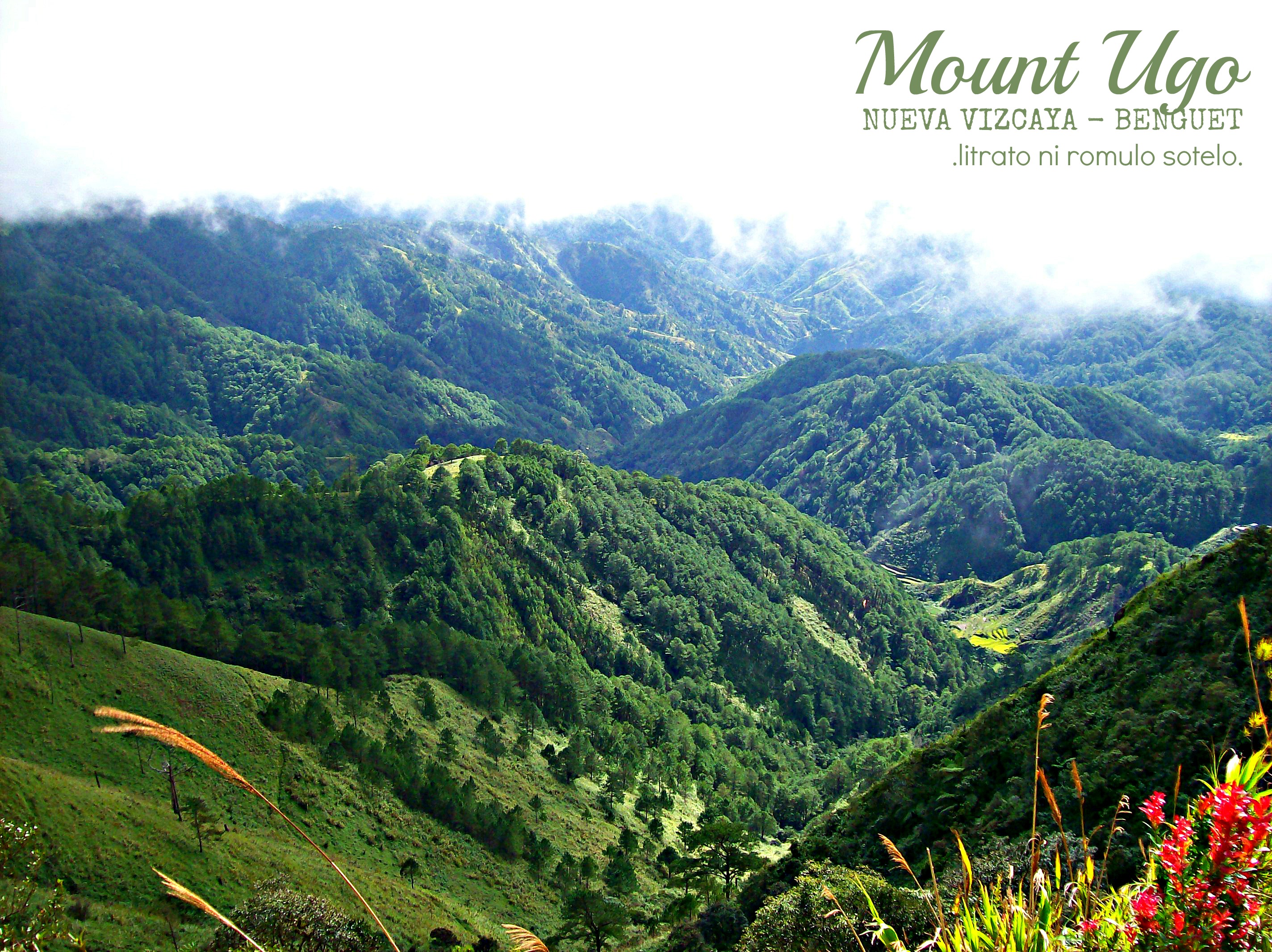
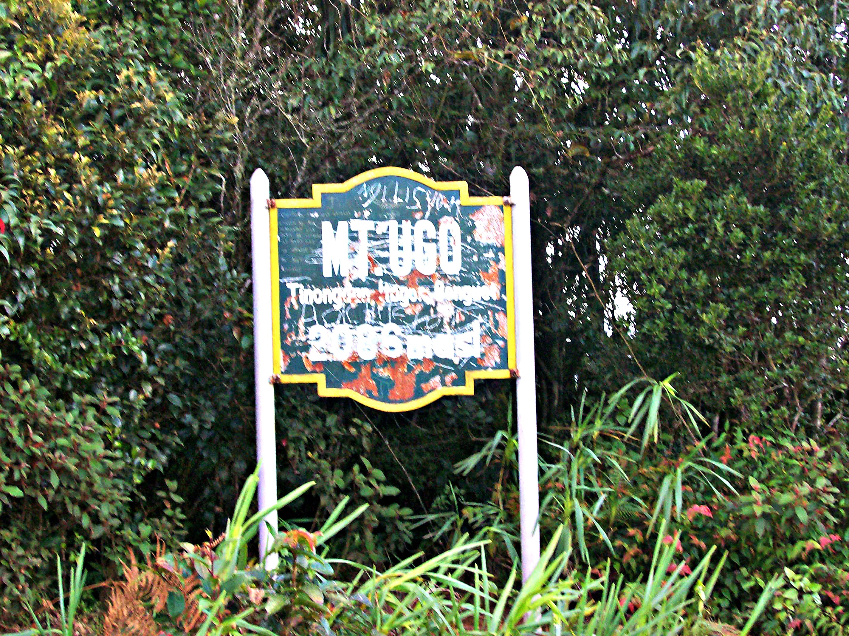
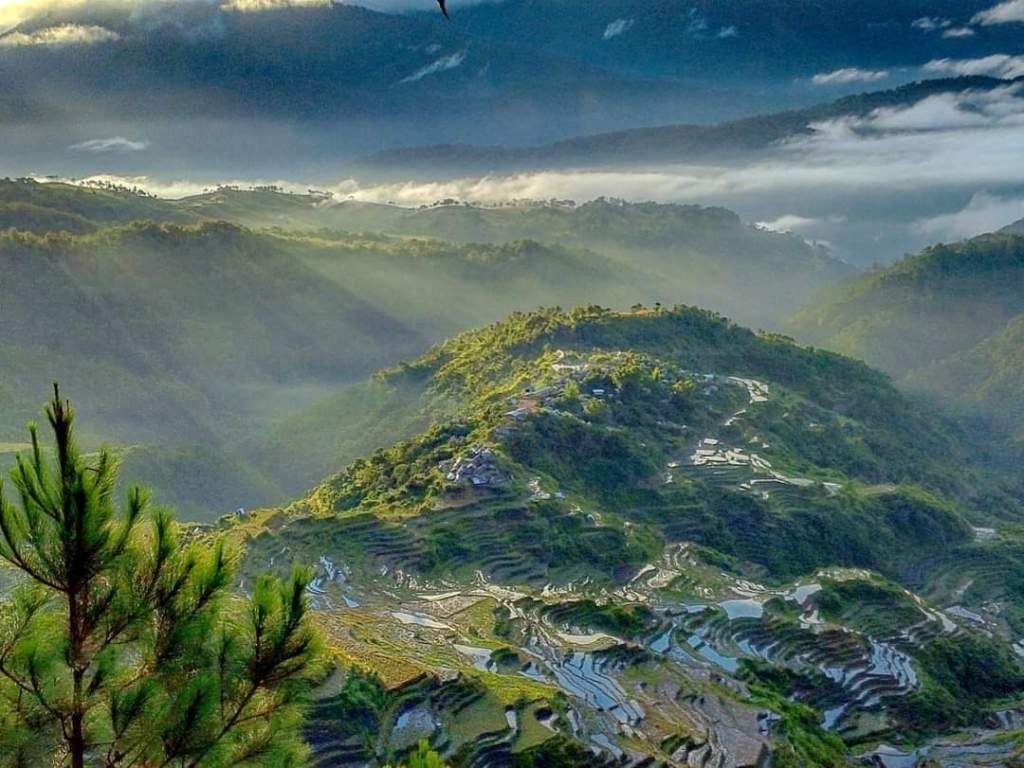
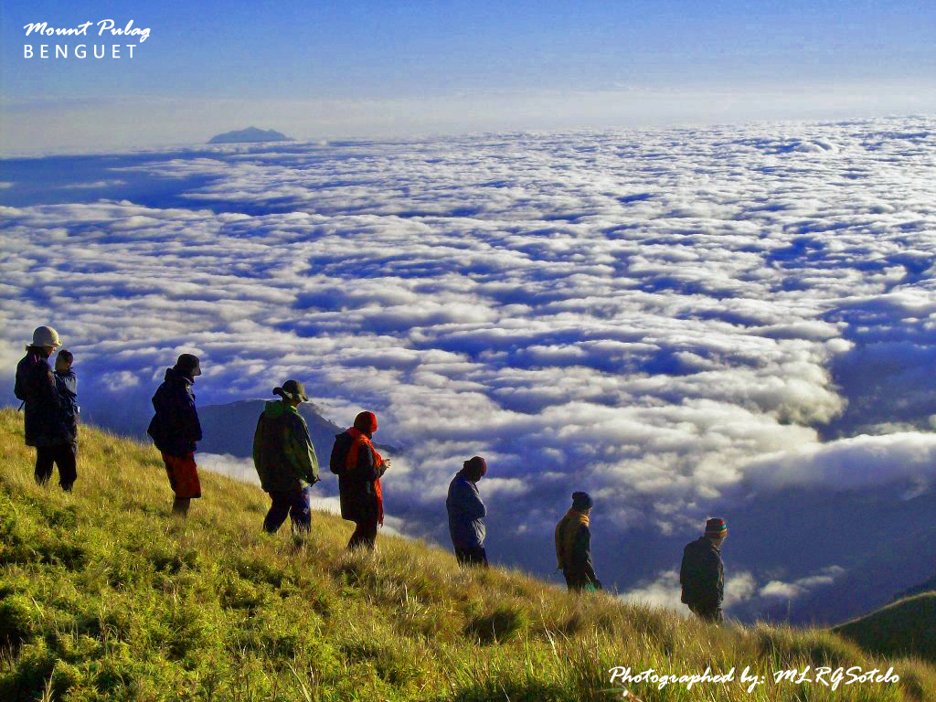
Mount. Ugo is one of the picturesque mountains of this mountain range. Now, it is one of the most known climbing destinations in the country. At 2,150 meters above sea level, Ugo is said to be one of the higher mountains in the Cordillera. At the peak, it presents a spectacular view of other Cordillera mountains, including the 2 of the highest peaks in Luzon (Mt. Pulag and Mt. Tabayoc.)

Quick Information about MT. UGO (taken from Pinoy Mountaineer):
Height: 2,150+ meters above sea level
Location: Nueva Vizcaya and Benguet
Jump-off points: Kayapa, N. Vizcaya; Brgy. Tinongdan, Itogon, Benguet
LLA: 16.31916°N, 120.80166°E, 2130 MASL
Days required / hours to summit: 2-3 days, 9-10 hrs
Specs: Major climb, Difficulty 5/9, Trail Class 1-3
Features: Pine forests, highland villages, views of Cordillera peaks
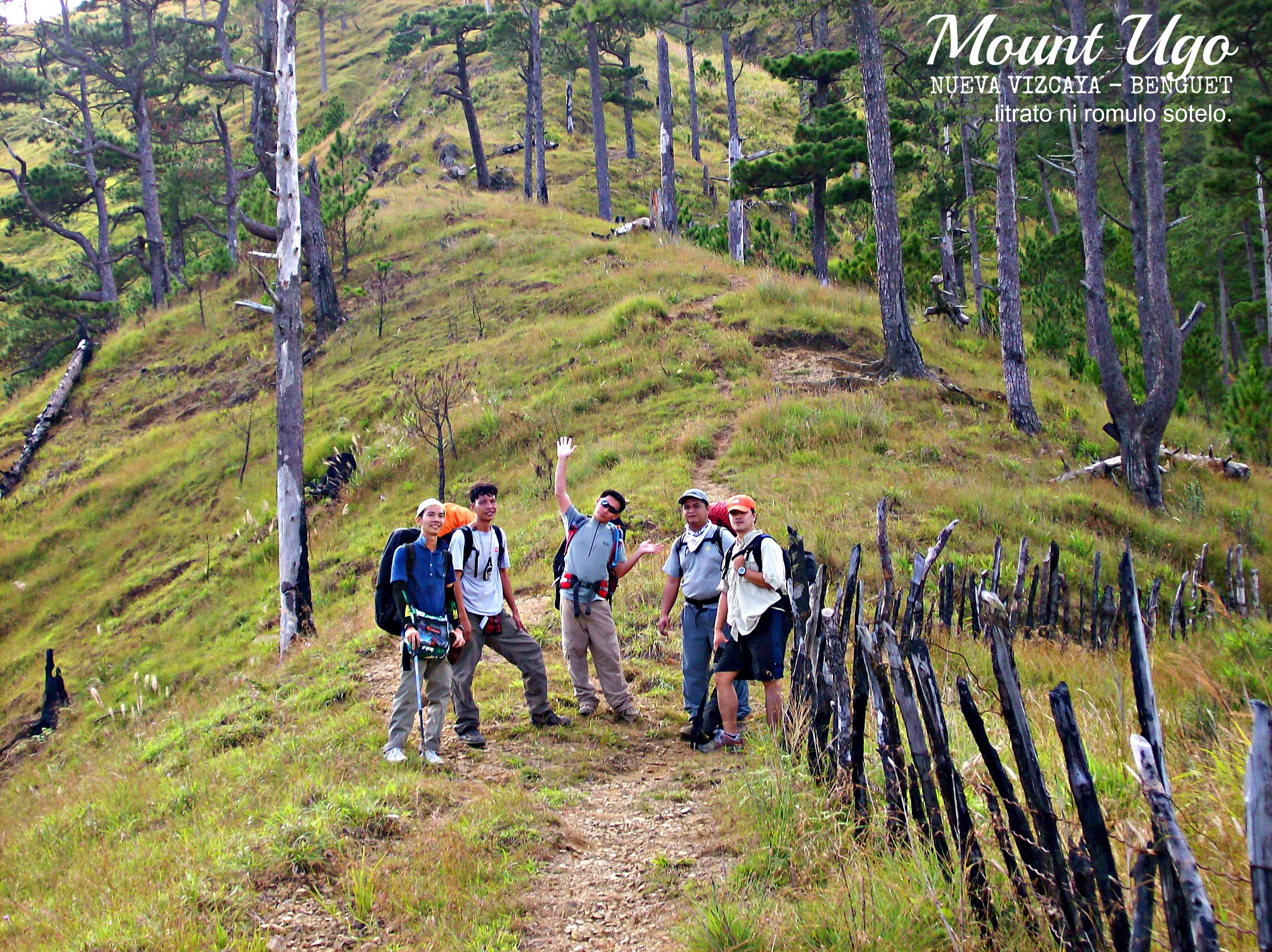
Many mountain-enthusiasts and adventure-seekers have proven that Mt. Ugo is unquestionably a great hiking destination. I was fortunate to have scaled this mountain waybacl 2007 with a group of awesome and like-minded mountain junkies. (Hi, sabit Mountaineer!).

The climb to Mount Ugo usually takes 2 – 3 days depending on how much you would like to enjoy your trekking. During our time, we allotted 3 days for the entire climb.
The climb starts with a bus ride from Manila to the quaint town of Aritao in Nueva Vizcaya. Travel time is about 6 – 7 hours. From the town, a jeepney waited for us and took us on a 2-hour winding ride up to a mountainous terrain until we reached the town of Kayapa (still in Nueva Vizcaya). We then had breakfast; bought some other supplies, and had an orientation before starting the climb. The first 2-3 hours of sauntering made us experience some vertical and challenging trail dotted with pine trees. The steep section ended at a village called Indupit, where we had our lunch.
The trail leading to the next village, Domolpos, was much easier since it was flat and wide bounded with awesome views. The walk took us around 2-3 hour before reaching Domolpos village that served as our camp site for the night.

The following day, we woke up around 6 am and had breakfast and began our trek to the peak at around 7 am. We were told to bring ample supply of water as water source is scarce along the way and with the expected scorching heat of the sun, water would definitely be a necessity. The trail during that day was mostly uphill. It was pretty exhausting but the scenic landscape made up for the almost weary feeling my body was experiencing.
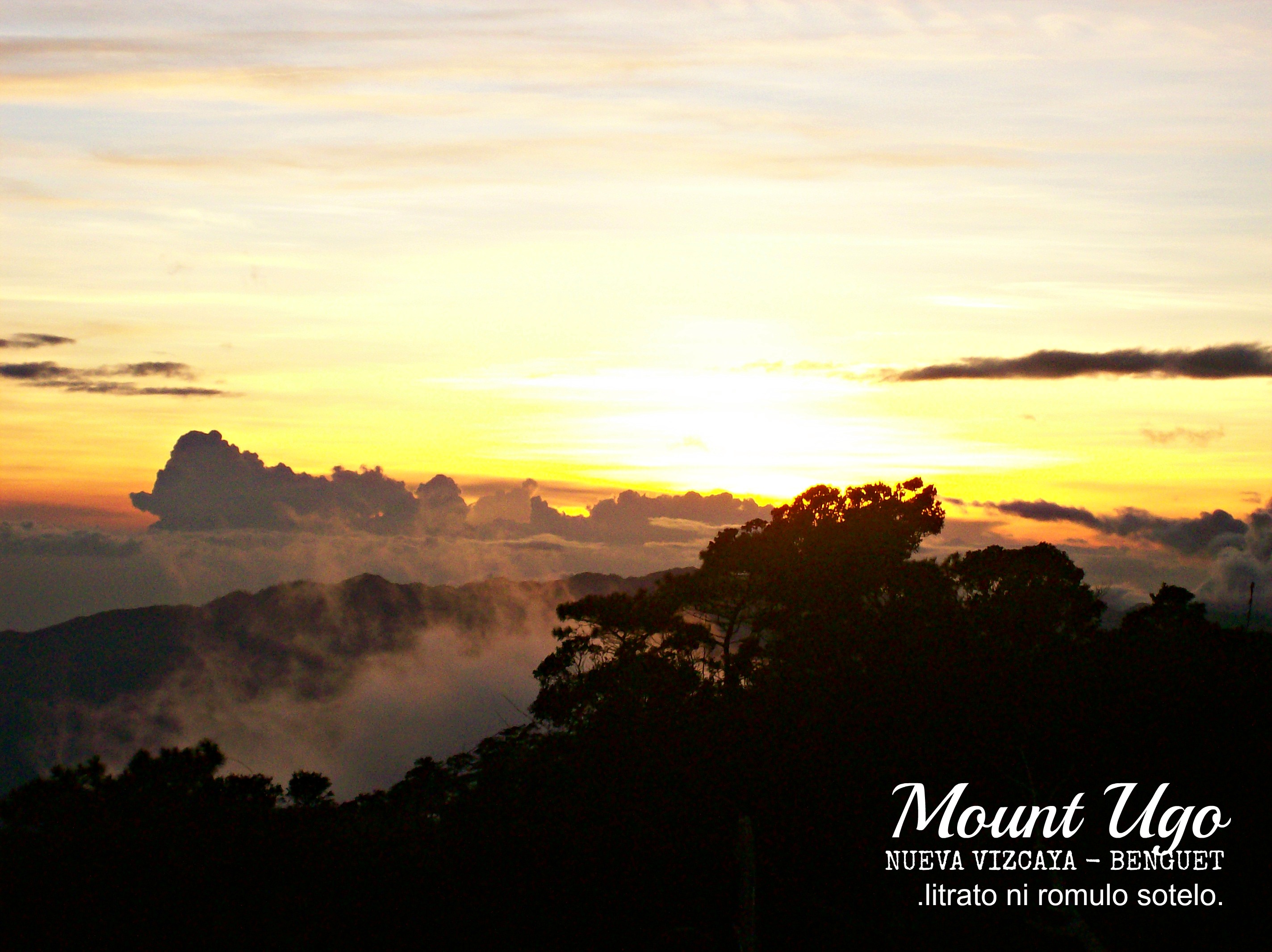
From time to time we take a long rest with lots of picture-taking in between. Those were our ways of re-energizing ourselves from the tiresome walk. We also had our lunch along the way. At around 3 in the afternoon, we reached the summit and pitched our tents. We spent the remaining hours of daylight exploring the place. The view from atop is always amazing. At the summit, major Cordillera mountains can be seen as you face north: Mount Timbak (N), Mount Pulag (NNE), Mount Tabayoc behind and beside it, among others. The other Benguet mountains NW may be obstructed and are too distant; Mount Napulauan (NE) is eclipsed by Mount Pulag. Prominent at the west side are Mount Sto. Tomasand Baguio City.
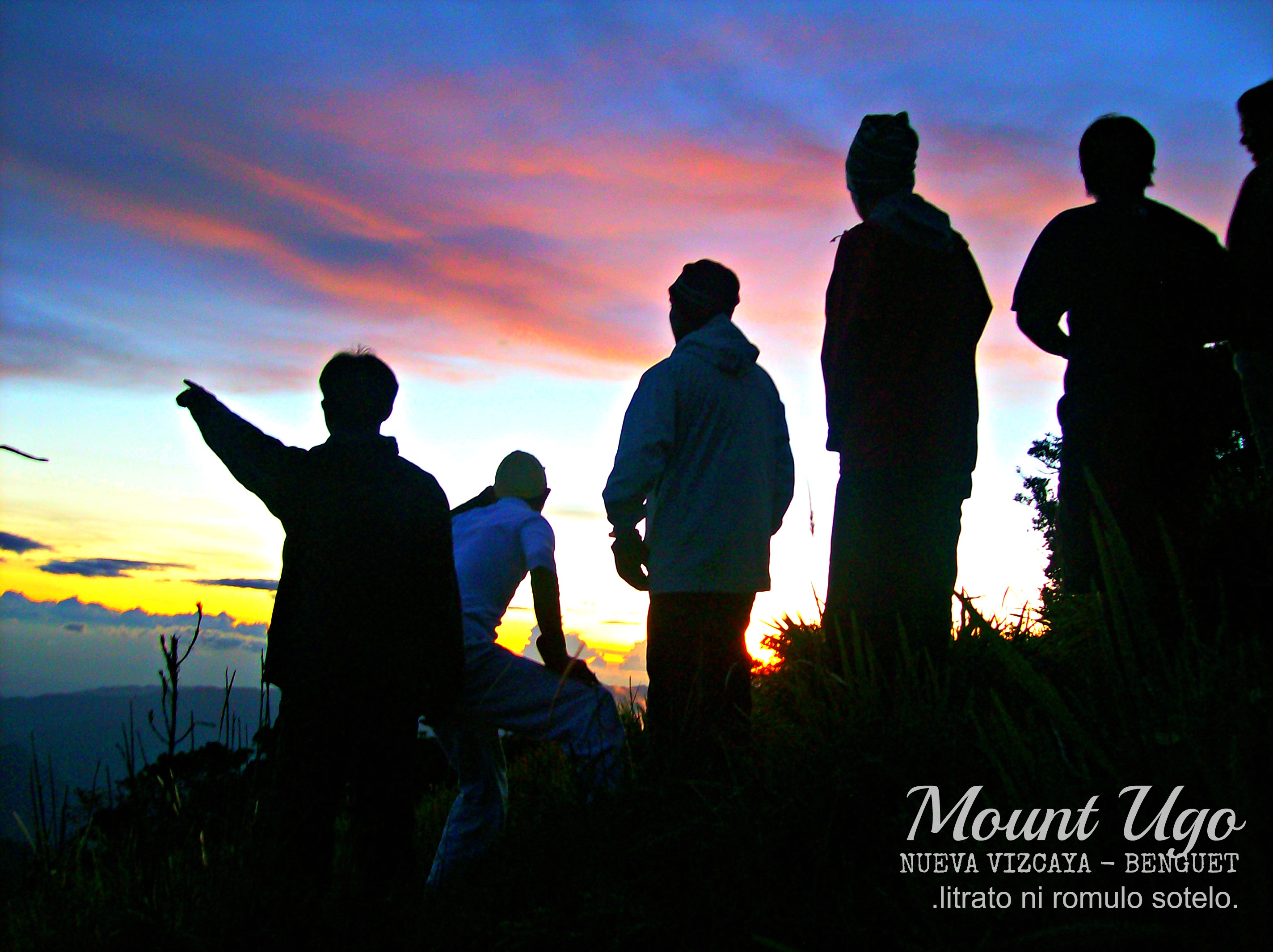
We waited for the sunset and although clouds and fog start to set in as well, the sundown was still quite a scene to behold. We spent a very chilly night at the summit. I went to sleep quite early to rest my tired body. The following day, we didn’t have to wake up very early since the itinerary for the day wasn’t as tough as our second day. We had breakfast and enjoyed the summit view one more time before packing up our way down.
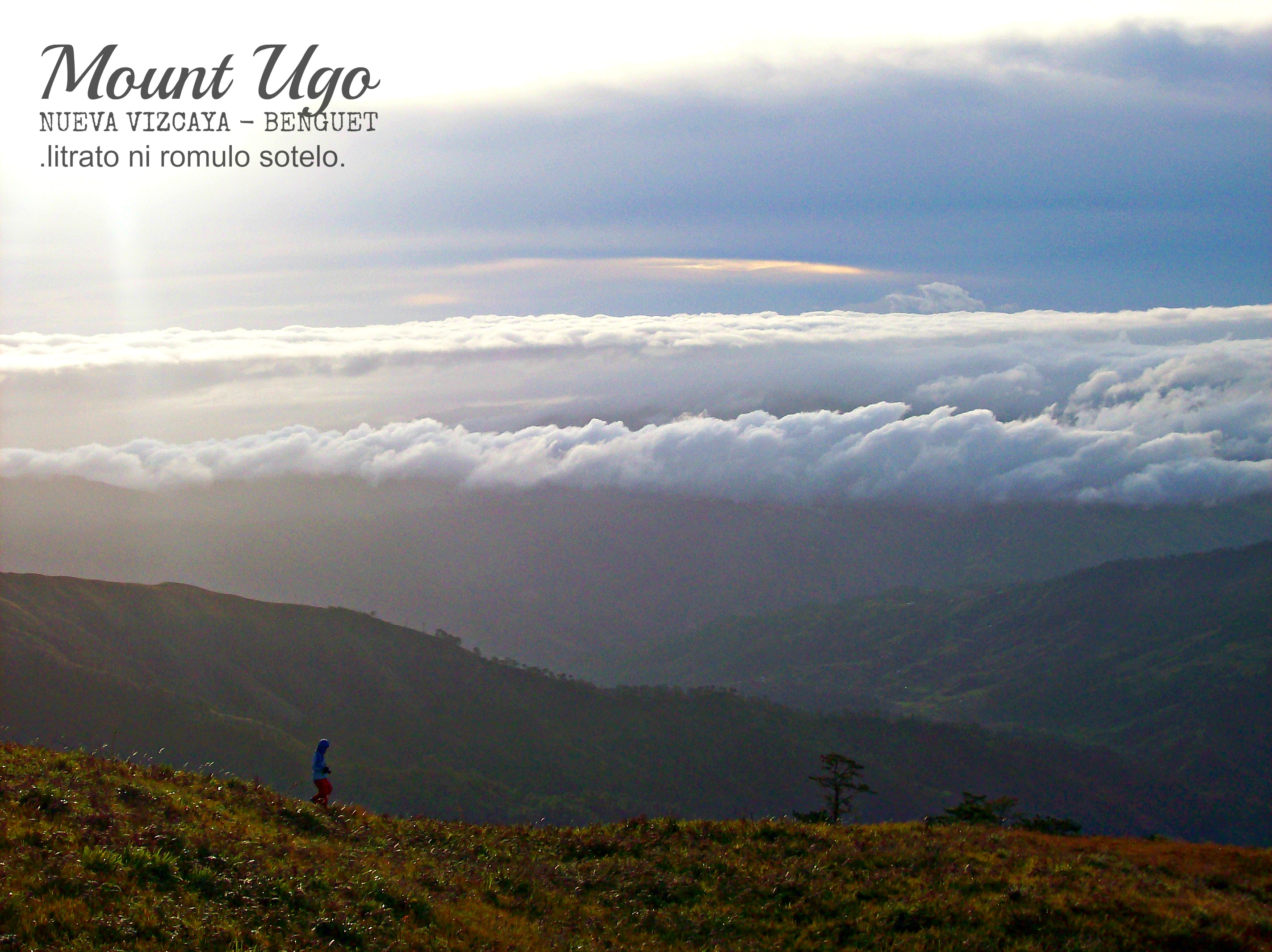
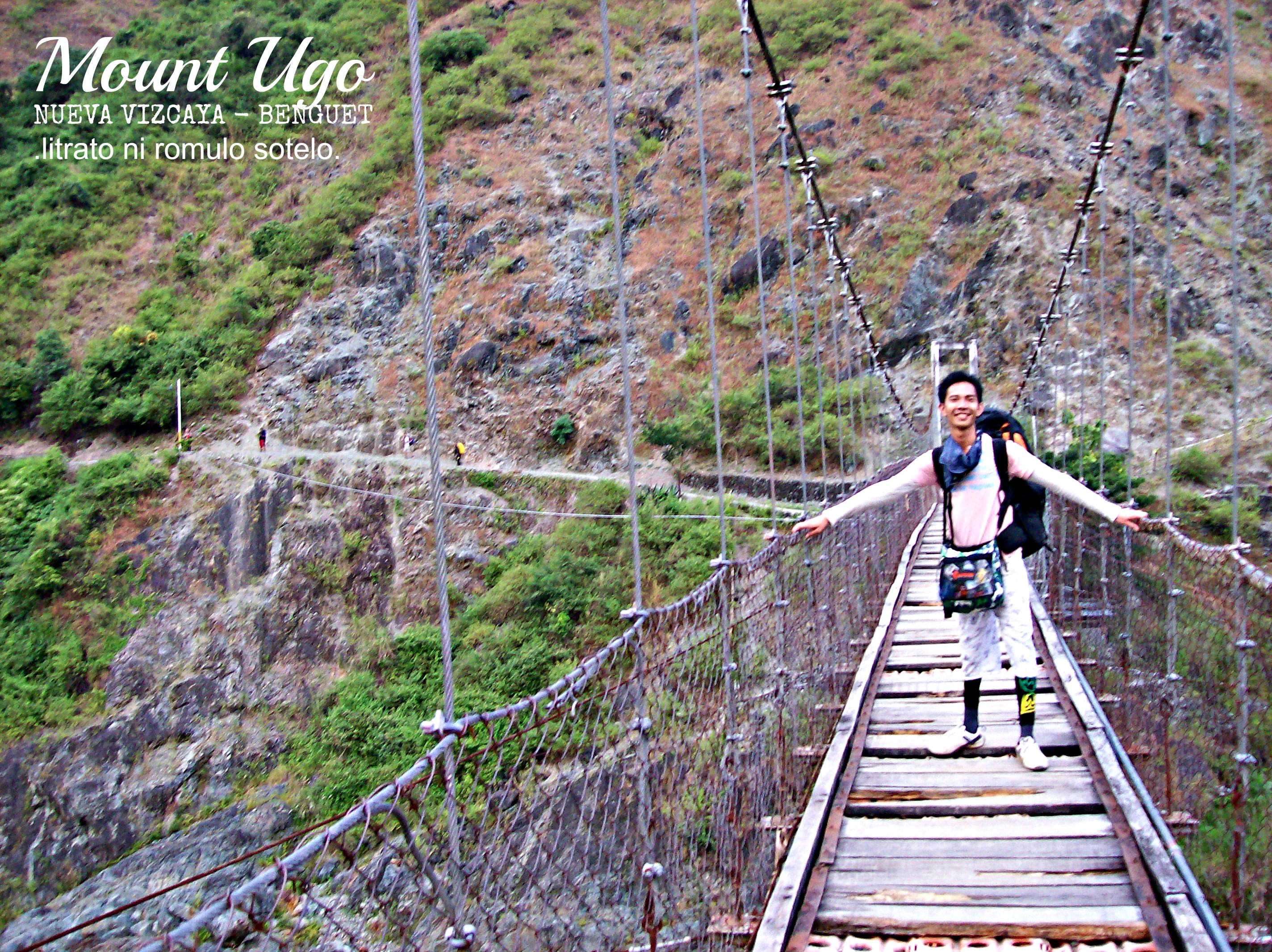
The opening descent, where we get to pass some mossy area, is sheer. The next segment is a pine forest, in which the descent is much easier. We had lunch along the way. The final stretch of the walk is through a sharp and bare trail before reaching Kawayan village. The last leg of the trip is crossing a 50-feet high hanging bridge. I always walking through hanging bridges so I was extremely delighted.

FYI: The name “Ugo” was derived from an Ibaloi word “Ugo-an” that translates into “to cut the neck”. Custom has it that the mountain used to be an area where the invading Spaniards were killed by way of cutting their neck. Contrary to the brutal origin of its name, Mount Ugo can be perceived as a landmark that showcases the people’s culture and beliefs.

How to Reach Mount Ugo’s Jump Off Point:
If one opts to do the Kayapa-Itogon traverse, take a bus going to Tuguegarao or Isabela. Travel time is around 6 hours. The Victory Liner bus station in Kamuning, Quezon City offers daily trips going there. Drop-off point is in Aritao, Nueva Vizcaya. From Aritao, take a jeepney to Kayapa town proper. Hike starts from there. However, if you opt to do the reverse, ride a bus going to Baguio City then ride a jeepney going to Tinongdan in Itogon. Victory Liner, Partas, Genesis and Philippine Rabbit buses have daily trips bound to Baguio.

SAMPLE ITINERARY (as suggested by pinoymountaineer.com)
KAYAPA-ITOGON TRAVERSE
(This is a reversible itinerary: you can choose to reverse the sequence of this itinerary for a Itogon-Kayapa traverse)
Day 0
2200 Assembly, Victory Liner GMA-Kamuning Station
2300 ETD for Bambang, Nueva Vizcaya via Isabela-bound bus
Day 1
0500 ETA Aritao or Bambang, Nueva Vizcaya
0530 ETD for Kayapa, Nueva Vizcaya via rented jeepney
0700 ETA Kayapa, Register at police station, secure guides, breakfast
08000 Start Trek
1200 ETA Indupit Village / Lunch
1300 Resume trek to Domolpos
1700 ETA Domolpos Village. Stay in the Elementary School
Day 2
0330 Wake up call, breakfast
0430 Commence final leg to summit
0700 ETA Mt. Ugo Summit (2150 MASL).
0900 Start descent on very steep, ridge-like pine forest trail
1200 ETA Lusod Village, lunch, register at Brgy. Hall
1300 Resume trek
1600 ETA Itogon Village; take pictures at Itogon bridge
1630 End of trek. Jeepney will be waiting past the river
1700 Arrival at Tinongdan barangay hall
1730 ETD for Baguio via chartered jeepney
1800 ETA Baguio, proceed to Manila by bus
Don’t be a wasted soul, be ‘juan’derlust. Take it easy ebri’juan’…


Leave a comment