“Nobody climbs mountains for scientific reasons. Science is used to raise money for the expeditions, but you really climb for the hell of it.” – Edmund Hillary

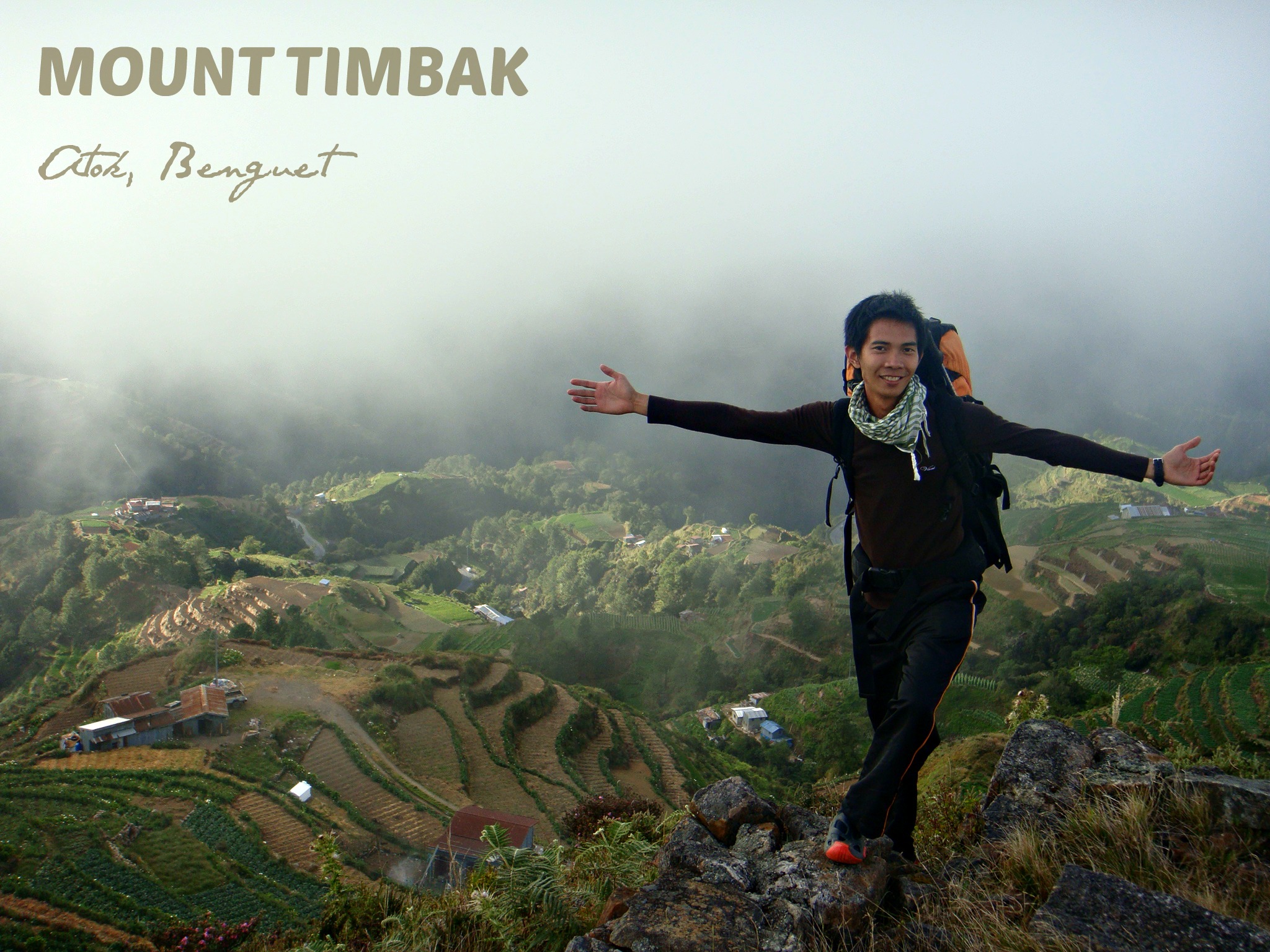
MOUNT TIMBAK
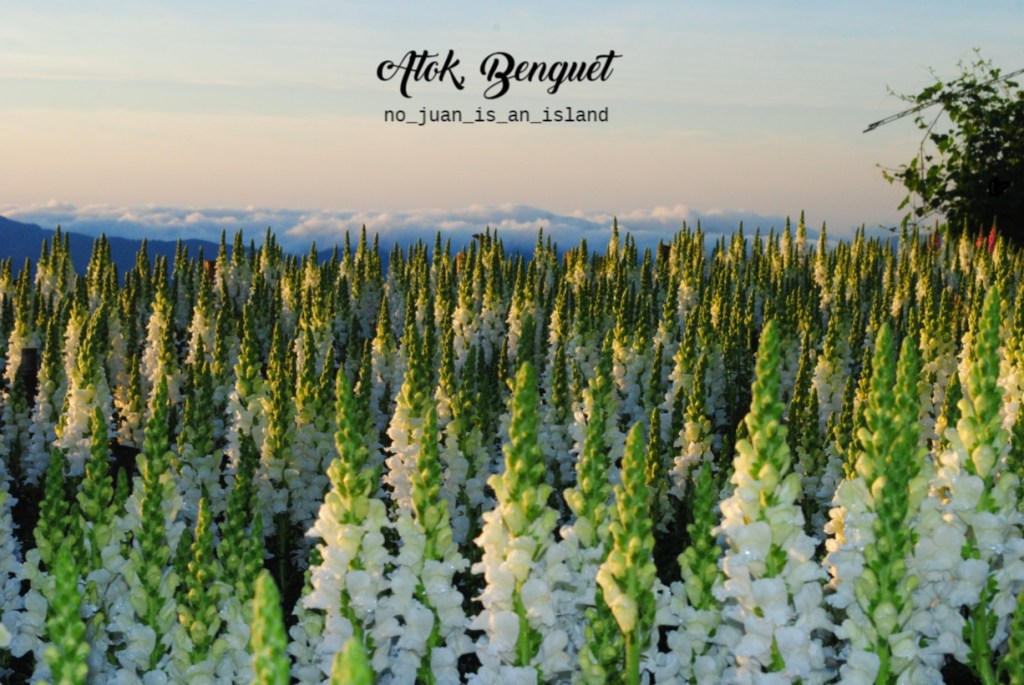
Major Jump-Off: Km. 55, Atok, Benguet
Elevation: 2717 MASL (8914.04 feet)
Days Required / Hours to Summit: 1 day / 1.5-2.5 hours
Specs: Minor climb, Difficulty 2/9
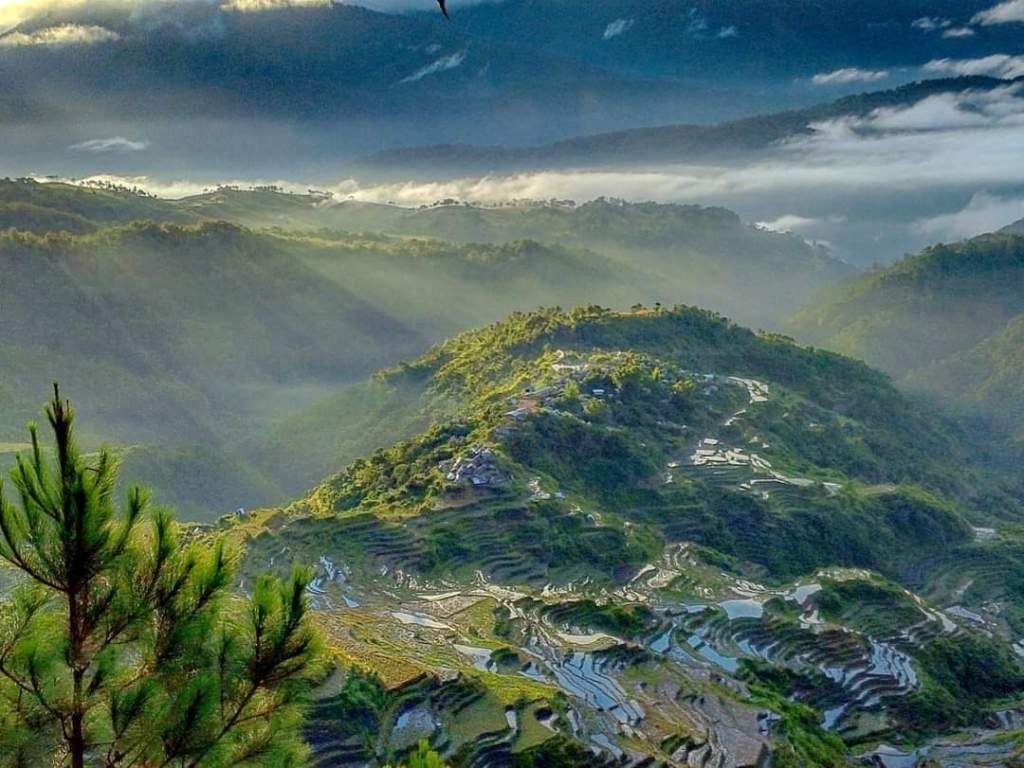
Features: cabbage terraces (sometimes carrots), mummies, village life, and views of major Cordillera peaks (like Mount Pulag)
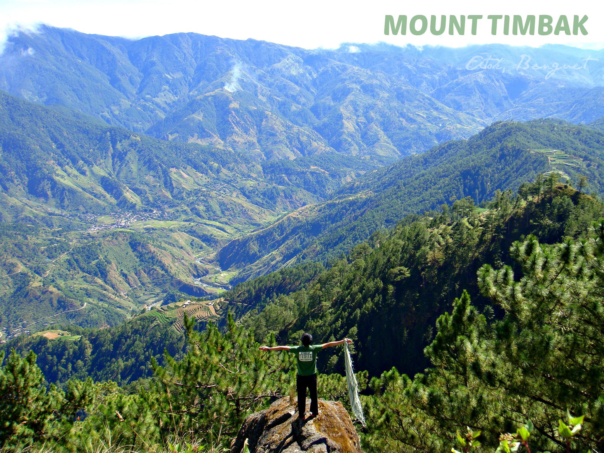
Mount Timbak – also called Mount Singakalsa is the 9th highest mountain in the Philippines and the 3rd in Luzon. It is one of the prominent peaks of the Cordillera Mountains range. If you happen to pass by the Halsema Hi-way, one would take notice of this mountain’s imposing beauty that serves as a backdrop of the highest point in Atok, Benguet.
It maybe the third highest mountain in Luzon, next to Pulag and Tabayoc, however, the hike is pretty much easy. Most people who scale the mountain not for its height but for the mummies and vegetable and flower terraces along the way.
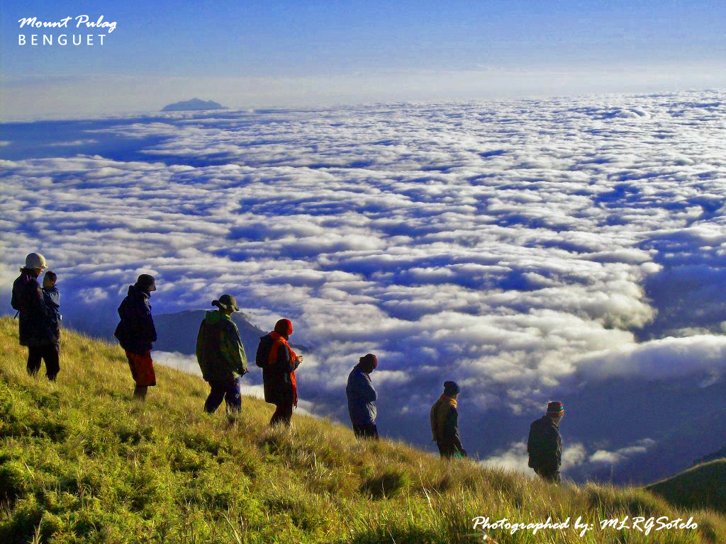
At the summit of Mt. Timbak are three crosses and some other religious figures. It is a great vantage point to see Mounts Tabayoc, Pulag, Purgatory, and Ugo on a clear day. One would be too glad to see also a sea of clouds, and if the weather is good – both sunrise and sunset viewing would be youre reward.

While one can do just a day hike to Mount Timbak, it would also be good to spend a night at the peak and experience a Pulag like weather. Find a flat area to pitch your tents on. Take note that the nightly winds (and even rain) can bring a very cold temperature.


How To Go To Mount Timbak:
Most mountain-enthusiasts go to Mt. Timbak from Manila or from Baguio City. Going from Manila first you must get to Baguio City. The easiest way is to get a bus from Metro Manila, from the Victory Liner Bus Terminal in Cubao, EDSA. Buses to Baguio leave every hour.
From Baguio, take a bus going to the direction to Bontoc, via the Halsema Higway. Buses going in this direction depart from the Slaughterhouse Road or the terminal of buses going to Sagada at the back of Center Mall. It takes about 2 hours to the jump-off point at the 55 km of the Halsema Highway.

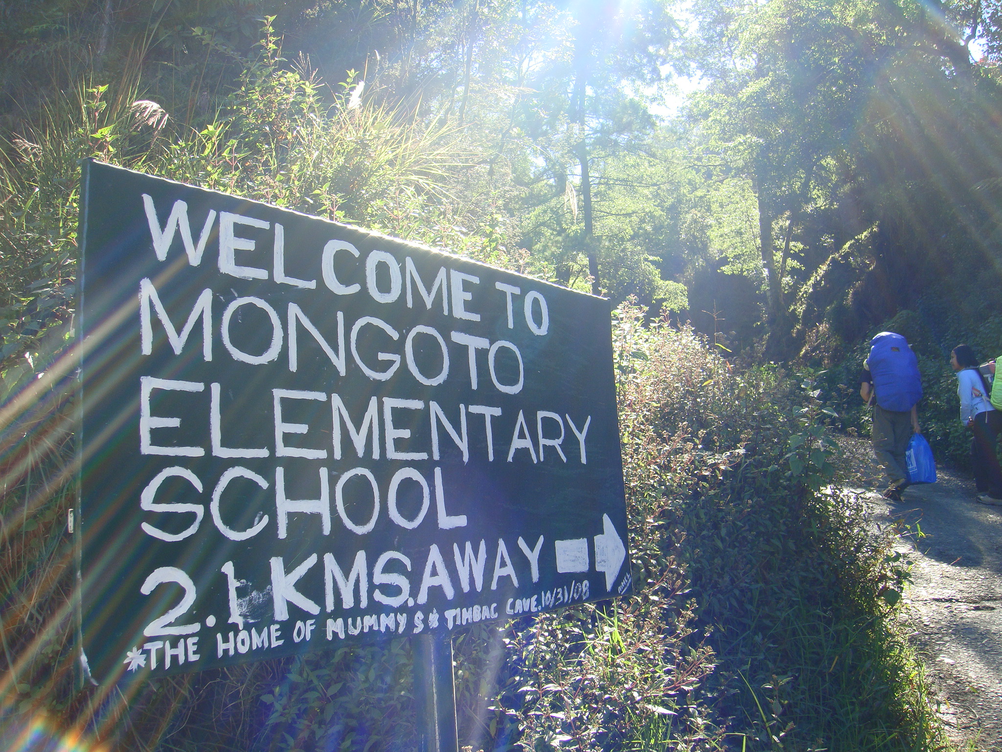
From the Halsema highway you have to turn right to a very steep cement-paved side road. If you stray away from the main path, all the other roads terminate at one of the houses of the locals who would then direct you back to the main road. The main road is actually the same road that traverses Timbak down to Kabayan Barrio. Then, one will pass by an elementary school. One may ask the locals for the trail to the peak. Following the main road farther would lead you to the Timbak mummies.

SAMPLE ITINERARY
Day 0 – If one is coming from Manila
22:00 – Assembly
23:00 – Departure Manila to Baguio City
Day 1
05:00 – Arrive at Baguio City / Breakfast / Buy supplies
07:30 – Proceed to bus terminal
08:00 – Depart Baguio City to Jump-off
10:00 – Arrival at jump-off (final preparation)
10:30 – Start trek (road trek)
11:00 – ETA Mongoto Elementary School / Lunch / Refill water
13:00 – Resume trek to camp or go and visit the Timbak mummies
14:00 – End of road
15:00 – ETA Mount Timbak summit/ Set-up camp / Free time / Socials/ Wait for sunset
Day 2
05:00 – Wake-up call / Sunrise viewing / Breakfast / Pack-up
08:30 – Start descend
10:00 – ETA KM 55
10:30 – Ride back to Baguio City
13:00 – ETA Baguio City / Free time
21:00 – Depart Baguio City to Manila (time may vary)
Day 3 – September 8, Monday
03:00 – Arrival in Manila


“Great things are done when men and mountains meet; This is not done by jostling in the street.” – William Blake)
***To date, I have scaled this mountain on 2 occasions, and it was really great to have influenced friends to come with me and enjoy the beauty of nature.
You can also check out (and hit the like button) my FB Page: https://www.facebook.com/roamulofied
Instagram: roamulofied


Leave a comment